Category Archives: Local Plan

How to make a planning application decision

Only properly trained councillors may serve or substitute on the Planning Committee. So we’ve been undergoing the required training.

Here are the policy priorities for deciding whether planning permission should be granted or refused.

  1. NPPF. (National Planning Policy Framework) This has a bias in favour of sustainable development. In the current situation where Vale doesn’t have a 5 year supply of housing land identified, basically every location is sustainable unless it’s the middle of nowhere. Vale tends to focus heavily on ease of access to transport and shops. I’ve not heard any attention paid to environmental sustainability, and Vale continues to build houses in areas with poor air quality. (I’m not clear if all of the official Planning Guidance docs issued by government are considered part of NPPF, for this purpose. I suppose they are.)
  2. Local Plan. Right now, we do not have an in-force local plan. We only have some saved policies from Local Plan 2011 – this is our OLD Local Plan. The saved policies have all been determined to be in accordance with NPPF. These saved policies are currently our only local plan policies.
  3. Neighbourhood Plan. A few communities have an adopted Neighbourhood Plan. A few more have begun the process of creating a neighbourhood Plan. You can see about it on the Vale website, although the information is out of date. http://www.whitehorsedc.gov.uk/services-and-advice/planning-and-building/planning-policy/neighbourhood-plans
  4. SPD. (Supplementary Planning Document). This Vale webpage explains what SPDs are, but the info is out of date. http://www.whitehorsedc.gov.uk/services-and-advice/planning-and-building/planning-policy/local-development-framework/supplementary-


Local Plan 2031 Part 1 – Inspector’s Examination in Public

IMG_1562The Examination in Public (usually referred to as EiP) of the emerging Local Plan 2031 Part 1 is scheduled for the week commencing 21 Sep 2015.

We expect to get notification of the process and who will be invited to testify sometime in late June.


The timetable reproduced below is taken from the Local Development Scheme on Vale website. All info relevant to the Local Plan is on this page. (http://www.whitehorsedc.gov.uk/services-and-advice/planning-and-building/planning-policy)Local Plan 2031 Pt 1 timeline

As you can see, it has already slipped by a few months. What was planned for June-July is now Sept-Oct.

As a reminder, there are 3 things in the Local Plan the Lib Dems object to:

  • Housing development in the Oxford Green Belt
  • SHMA figures accepted as housing targets in Vale, without regard to constraints
  • Botley’s ‘central area’ being defined by one developer’s aspiration from their failed planning application.

Botley Redline Area?

Botley Area Redline smallerThe Vale Tories used a Doric definition as their policy for Botley Central Area in Local Plan 2031. Now that the Doric planning application has been refused, another big problem with the Local Plan 2031 is clear.

I objected many times to Doric having a hand in forming planning policy. I was variously assured by senior officers that a) developers have no role to play in policy formation, and b) that it was usual and helpful  for developers to have a hand in policy formation. So, which is it? Both of these things can’t be true.

IMG_1571Doric wanted to demolish the Vicarage, Elms Parade and Field House (after seizing them by Cumpulsory Purchase Orders that the Vale would execute, if necessary). Now that their planning application has been refused, there is to be a second plan, with a smaller footprint, which excludes these three properties.

Top two photos are from page 58 of the Vale Tories’ Local Plan 2031. (Click on them to make them bigger and easier to read.) The blue one below is the actual policy, from page 59 of the Vale Tories’ Local Plan.

Doric's policy for Botley

This policy for Central Botley came from Doric.

Now that Doric have successfully insinuated their pipedream into the Vale planning policy via the Local Plan 2031, how will any other panning application ever be in accordance with the Local Plan? I don’t see how this can possibly work.

If the Vale Planning department and planning committee consider their own policies as material planning considerations, then any planning application for other than the original Doric redlined site would be refused. Wouldn’t it?

I wonder if there is now any way to point out this late-arising problem to the inspector? So that s/he can throw out the ridiculous policy for Central Botley.


Printed (hosted) by Hostgator, 11251 Northwest Freeway, Suite 400, Houston, TX, 77092, USA. Published and promoted by N Fawcett on behalf of Debby Hallett (Liberal Democrats), both at 27 Park End Street, Oxford, OX1 1HU, UK.

The Problem with the Tory Local Plan 2031

IMG_1562Vale Tory logic about their Local Plan 2031 just doesn’t hold up to careful scrutiny.

Check this out.

The SHMA figures (Strategic Housing Market Assessment) for required housing over the next 15 years are high. They were established by local businesses based on their projected growth. Companies always optimistically project their own growth. Many people and organisations think the SHMA figures are unrealistically high.

SHMA housing figures were explicitly intended to be the baseline. Local authorities were expected to apply relevant local constraints to come up with a realistic housing target.

Vale Tories have repeatedly said there were no constraints in the Vale, so the SHMA figures had to be accepted as the real, objectively assessed need for new housing development.

Vale Tories propose to build thousands , okay, several hundreds of new homes in the Oxford Green Belt. (Whether they build in the Green Belt, or redefine the boundaries of the Green Belt so as to have access to that land for development, it’s the same thing.) Tories believe the only way they can meet the housing targets is to build in the Green Belt.

Isn’t that the very definition of the word ‘constraint’? If we do not have enough land to build the required number of houses without Green Belt land, then that is a constraint, and the target number of houses in the Local Plan should have been reduced.

I asked about this specifically, at the Vale Scrutiny Committee in 2014, when we looked closely at the most controversial areas of the Local Plan. No one would answer this question.

Vale Tories and their Vale officers repeated, over and over, that there are no constraints in the Vale, so we are forced to accept SHMA figures as targets.

Ridiculous. Illogical. Ruinous to our open spaces.

2014 cumnor cricket site

Emily Smith, Judy Roberts, Layla Moran, Dudley Hoddinott, Debby Hallett. In the Green Belt, Cumnor

Green Belt legislation explicitly says lack of housing land supply is not enough of an exceptional circumstance to allow development in the Green Belt.

A few months ago, Eric Pickles published some new government guidance about this.

http://www.telegraph.co.uk/news/earth/greenpolitics/planning/11139303/New-protections-for-Englands-Green-Belt-unveiled-by-Eric-Pickles.html

Here’s the bottom line (from the article in link above):

A Government source said: “Many council planning officers are telling their councillors that they have to remove Green Belt protection when drawing up their Local Plans, in order to meet [housing] demand.

“We are making clear that this isn’t the case, and they can take into account development restrictions – such ongoing Green Belt protection – when drawing up their Local Plans and determining how many houses they want to plan for.”

#LogicFail

Printed (hosted) by Hostgator, 11251 Northwest Freeway, Suite 400, Houston, TX, 77092, USA. Published and promoted by N Fawcett on behalf of Debby Hallett (Liberal Democrats), both at 27 Park End Street, Oxford, OX1 1HU, UK.

Vale’s BIG 3 consultation

Between now and 19 December (at 4:30pm, precisely), you can have your say on three key Vale Planning policies.

Here’s what the Vale’s own official notifications say:

1. The Local Plan 2031 Part One: Strategic Sites and Policies looks at strategic planning across the Vale up until 2031. The plan provides guidance on the provision of land for 20,560 new homes in the district from 2011 to 2031. This is the final consultation on the Local Plan 2031.

2. The Vale of White Horse Design Guide Review provides guidance to decision makers and those wishing to develop housing on the rules we will use to assess high quality, well designed homes and neighbourhoods in our district.  This is so we create successful places that people want to live and work in.

3. The Vale of White Horse Community Infrastructure Levy (CIL) – Preliminary Draft Charging Schedule.This is the first of two consultations on the charging schedule. CIL is a mechanism that we can use to raise funds from new development to provide infrastructure which is required to support the new development across our district.

To see the Local Plan 2031 and supporting evidence: www.whitehorsedc.gov.uk/lpp1

To see the Design Guide: www.whitehorsedc.gov.uk/design

To see the CIL charging schedule: www.whitehorsedc.gov.uk/cil

To participate in the consultation, (you need to register once only to use the consultation site) https://consult.southandvale.gov.uk/portal/vale/planning/pol/lpp1/lpp1_1/lppub


Vale Press Release – Local Plan 2031, final consultation

The following is the actual press release from the Vale, issued today.

PRESS RELEASE

Issued on 5 November 2014

Vale prepares to submit its Local Plan to the government

Vale of White Horse District Council is making the final preparations to submit its Local Plan to the government.  It is inviting people to make comments on the draft plan and the way it was put together, which will be considered by a planning inspector when he or she examines the plan.

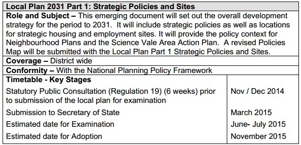
The Local Plan is a document that sets out where new houses and employment sites across the Vale will be, and what infrastructure the Vale will need to support it.

Earlier this year and in 2013, whilst drafting the plan, the Vale asked people across the district for their views on its proposals. People who responded included residents, community groups and a wide range of national organisations, and their comments have had helped update and improve the plan throughout the process.

Changes to the plan include:

  • decreasing the size of the proposed housing site at Milton Heights by 1,000 homes because of traffic concerns;
  • a site in south Shrivenham being removed, with part of its allocation being added to the site north of the village, partly based on the preferences of local residents;
  • a reduction of the size of a site at east Harwell following comments from Natural England and the AONB Board; and
  • sites removed from the Green Belt at Cumnor, Wootton and North Radley.

Recognising the district will need continued investment in infrastructure to support all the new housing that will be provided over the course of the Local Plan, the Vale is introducing an additional source of funding for infrastructure.  This is called the Community Infrastructure Levy (CIL), which is essentially a tax developers have to pay on new developments. 15 per cent of the levy goes to parish councils, 25 per cent if they have a neighbourhood plan in place, with the remainder going to the district council.

The Vale has a list of infrastructure projects it intends to fund in whole or in part from CIL. Money raised from CIL across a number of developments can be pooled together to raise funds for these and other infrastructure projects that can benefit the whole district.

The Vale is asking people what they think about the charges they’re proposing to make.

To make sure the new developments in the district are well-designed, well laid out and respectful of their surroundings, the council has also completely overhauled its Design Guide, which is a document used by developers to make sure they design homes and communities in line with the needs of the local area.  The council’s planning officers also use the document when deciding if a planning application is acceptable.

The district council is also asking people to have a look at the draft Design Guide and provide their thoughts before the council finalises it and then starts using it early next year.

For more information and to find out how to respond, residents can go to the council’s website at www.whitehorsedc.gov.uk/localplanconsultations

Cllr Mike Murray, cabinet member for planning policy at the Vale, said: “Thanks to everybody’s comments over the past couple of years, we have put together a robust plan that we’re confident will get the planning inspector’s green light. This is a crucial step on the road to getting ourselves back in control of planning in the Vale.  Whilst finalising the Local Plan, we have also been working hard to make sure all new developments in the district are well supported by infrastructure, and the introduction of our Community Infrastructure Levy will help us do that.  The overhaul of our Design Guide will make sure that all new developments will be well-designed and respect the character of our district.”

Consultation details

The consultations on the following documents all run from 7 November until 4.30pm on Friday 19 December.

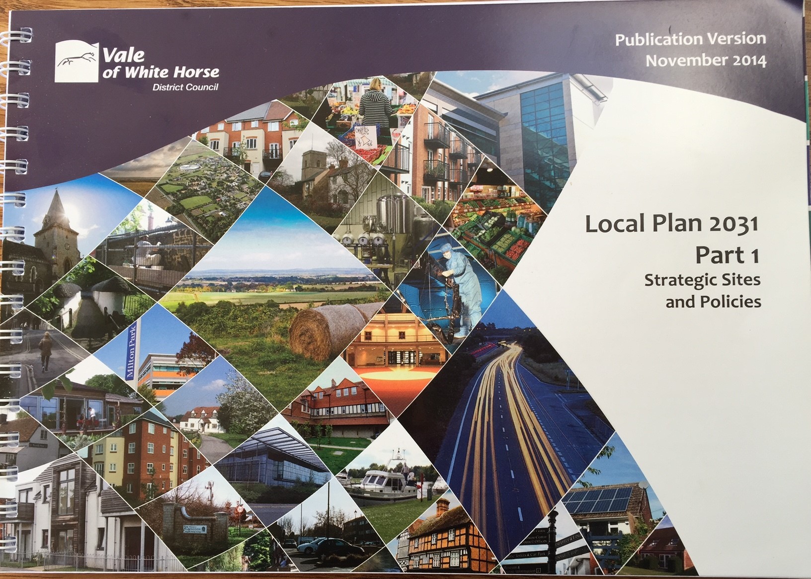
  • Local Plan 2031: Part 1 (publication version)
  • Community Infrastructure Levy Preliminary Draft Charge Schedule
  • The Vale Design Guide Supplementary Planning Document

Oxford mail covers my policy change win

lib-dem-team-aLib Dem team at West WayThere’s good news for Botley in the Oxford Mail. (I hope you can follow the story.)

If you know me at all, you’ll agree the newspaper used a hideous photo. I look like a drunken crone. I may be a crone, but…

In the photo on the left, is Judy Roberts, Emily Smith, Layla Moran, me, Dudley Hoddinott, in a photo taken last winter. I think we all were quoted in the newspaper article except for Layla.

Here’s the link: http://www.oxfordmail.co.uk/news/yourtown/oxford/11546937.Changes_to_Local_Plan_could_block_student_flats_in_Botley___but_not_Doric_scheme/

Our Green Belt needs Protecting

2014 cumnor cricket siteThe Tory adminstration at the Vale plans to take several large sites out of the Green Belt for development. I’m against the piecemeal nibbling away at the Green Belt. Yes, I know we need new homes. I think there are other sites where we can build and without endangering our open green spaces. We should protect our villages against the coalescence that the Green Belt legislation foretold.

At the Vale Council meeting on the 15th of Oct 2014, I spoke in support of a Lib Dem amendment to take the Green Belt sites out of the Local Plan 2031, and commit to a review of the Oxford Green Belt in its entirety.

Here’s what I had to say:

The officers and the ruling party are sending conflicting messages about building in the Green Belt, which are leading to reckless policy decisions, and reckless endangerment of our remaining open spaces.

Officers have told us that there is no credible constraint against accepting the SHMA figures as targets. In Scrutiny last month they said that it’s ‘obvious we have adequate land to meet our objectively assessed need’ as derived from SHMA. So there is just no credible way to adjust the targets downward.

Cllr Constance, in her question tonight, asks the Liberal Democrats for our help in identifying housing sites other than those in the Green Belt. In other words, the current administration sees no way to meet our OAN without building in the Green Belt.

So, which is it? Either we have enough land, ergo no room for manoeuvre. Or we don’t have enough land, ergo we have to build in the Green Belt (or in Areas of Outstanding Natural Beauty).

In early 2014, very late in the Local Plan process, Conservatives came to believe that there weren’t enough strategic housing sites without using the Green Belt. So they called for a review of the Green Belt. That review says its purpose was, ‘…to inform Council’s identification of potential contingency sites for housing,’ and that, ‘…it may be necessary to release land for development.’

The framers of the Green Belt legislation were prescient. They realised that housing need would grow, and they explicitly stated in the legislation that housing need was NOT enough of a reason to build in the Green Belt.

This local plan is reckless. It takes protection away from Green Belt land, forever.

Officers say it’s obvious we have enough land, so no way can we adjust our targets down from the SHMA OAN. But the administration says there isn’t enough land unless we build in the Green Belt. One of those things is false.

I don’t support this Local Plan. It’s not been carefully analysed, and it’s not been thought through. It’s reckless.

The vote split along party lines, with the one Labour and one Independent councillor both voting with the Tory majority.

(There was a bottle of fine wine on offer to the person who used ‘Reckless’ the most. Cllr Bob Johnston put us all to shame. 🙂 )


What’s different about this Local Plan consultation?

The final working draft of the Vale’s Local Plan 2031 Pt 1 is published ( http://whitehorsedc.moderngov.co.uk/ieListDocuments.aspx?CId=103&MId=1883 and scroll down to item 5). It’s being tidied up in preparation for submission to the Sec of State for approval. Before it’s submitted, there’s one more consultation. It’s a little bit different to other consultations.

For THIS consultation, comments are sent to the examining inspector associated with the Secretary of State, rather than to the local council. There’s a six week consultation and then a several months long examination before approval. Or non-approval. (I don’t know how that works. )

For THIS consultation, no substantive changes to the Local Plan 2031 Pt 1 are allowed after. Essentially, the Vale administration are publishing a Local Plan they are happy to live with and take forward for adoption. (Not including typos and any sort of unclear wording of course.)

So far, I have two main areas of concern

  1. Changes to the boundaries of the Oxford Green Belt that fall within the Vale. (I think there should be a collabortive, joined up review by all authorities who have Oxford Green Belt land within their boundaries.)
  2. Designation of Botley as a ‘district centre in the context of Oxford city’. I don’t know what this means, and no one has thus far answered my question about it. (But I have a suspicion it has to do with justification for the proposed student housing, which does nothing to help the people of Botley or the Vale.)

At this point, I’m not supportive of the Tories’s Local Plan 2013 Pt 1.